Mt Magazine site info
Revision Date: March 24, 2025
Launch
35.1634 -93.6420 Paris, Arkansas
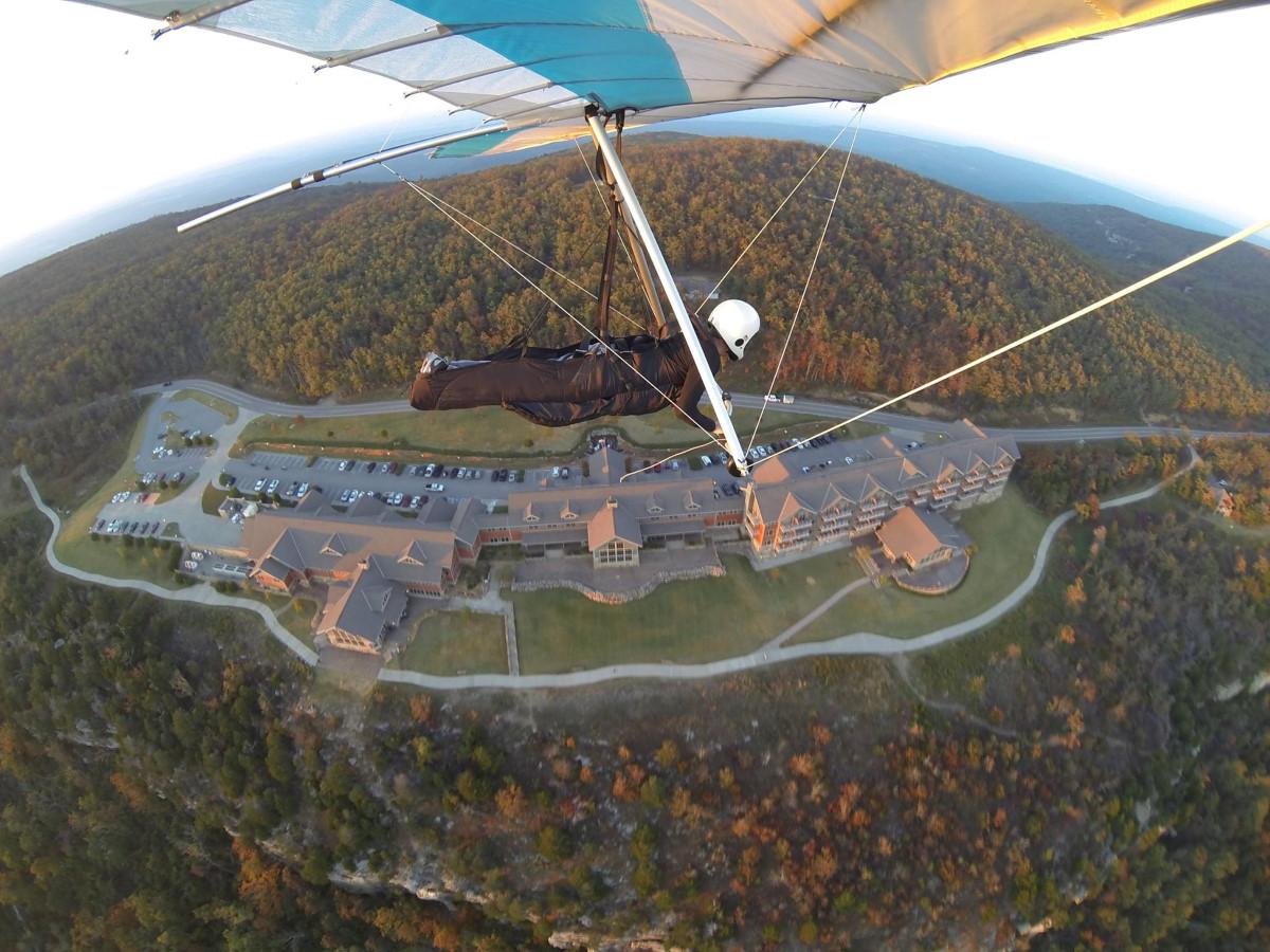
photo by Allen Tarver
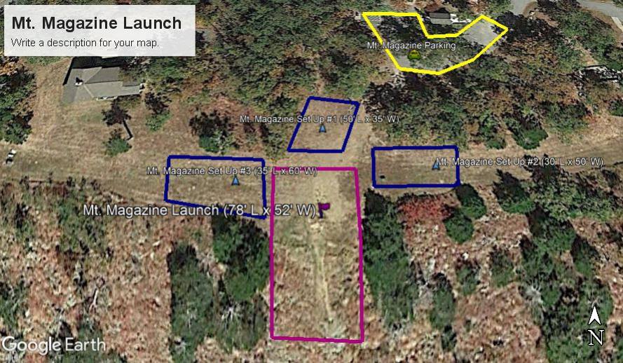
launch = magenta, glider setup = blue, parking = yellow
| Requirements for pilots | Paraglider | Hang Glider |
|---|---|---|
| Minimum required rating and special skills | P3 | H3 |
| Recommended wind limits (mph) | Min:0 | Min:3 |
| Ideal:7 | Ideal:10 | |
| Max:15 | Max:20 | |
| Gust:5 | Gust:5 | |
| Wind direction ideal for PG & HG | 185° | |
| Wind direction OK for PG & HG | 165°-205° |
| Launch altitude ft | 2,517 |
|---|---|
| LZ altitude ft | 545 |
| Launch to LZ distance | 2.1 mi |
| Glide ratio to LZ | 5.6 |
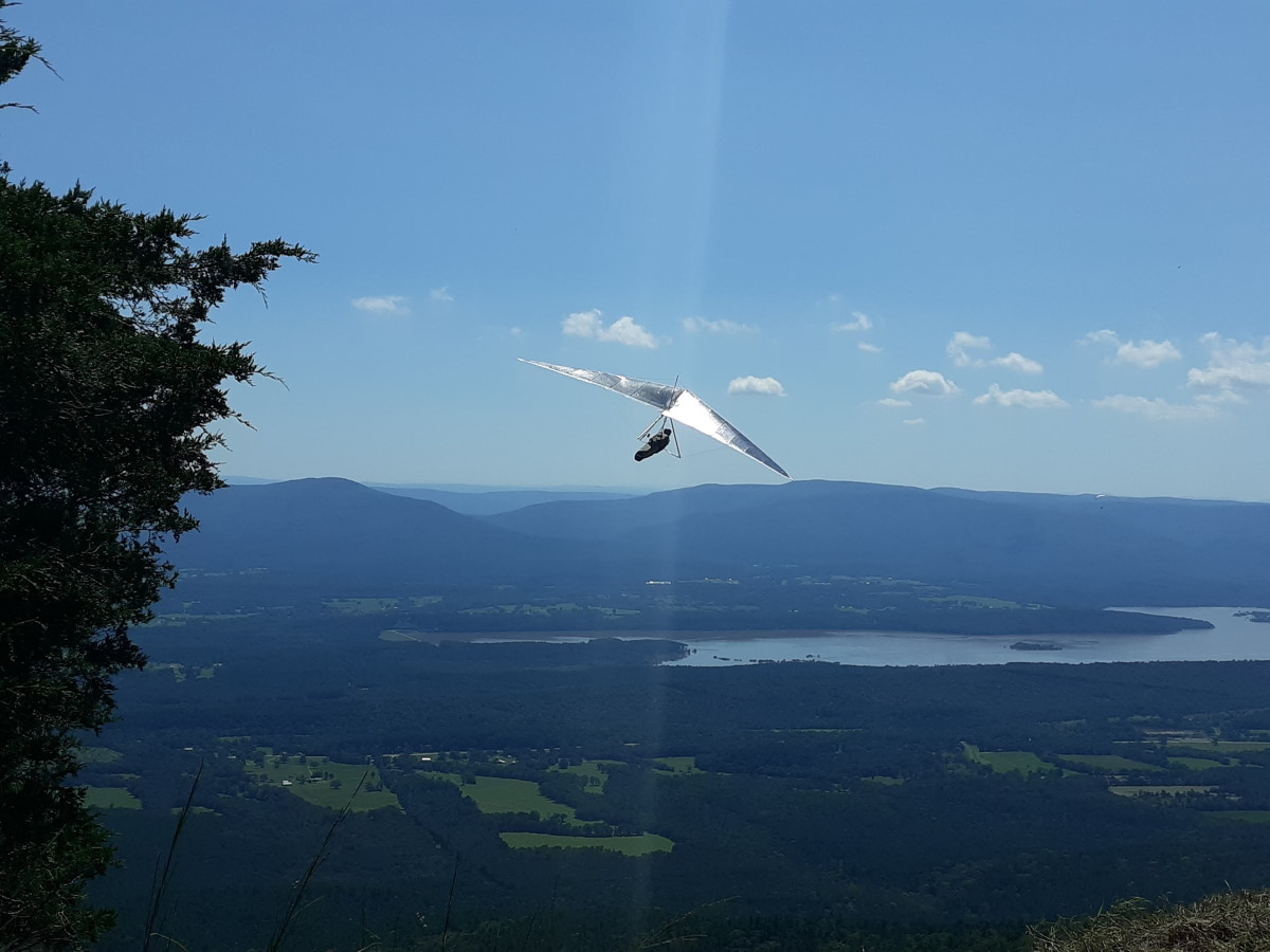
photo by Donald Briley
Visiting pilots should visit the Albright landing zone before flying this site.
PG
The hazard for PG is the long glide to the LZ (over 2 miles) with no bail out. Low performing gliders may not be able to reach the LZ if significant sink is encountered.
HG
The launch site is located in a slot through the trees with minimal clearance. Because Mt. Magazine is operated by the state parks we may have numerous spectators when flying activities are conducted. It is the pilot’s responsibility to communicate with spectators and request they maintain the required clearance BEFORE launching: no spectators in front of take-off, 30 feet or more behind take-off, and 30 degrees or more to the side and behind take-off.
General notes
Mt. Magazine State Park is located on the highest mountain in the state of Arkansas. The state park Visitor Center is located 16 miles south of Paris Arkansas on Arkansas Highway 309 or 10 miles north of Havana, Arkansas, on Arkansas highway 309. The launch site is a south facing slope launch to the edge of a bluff line which extends over 2 miles east and west on either side of the launch. This site is primarily a thermal flying site which also offers great opportunities for ridge soaring. On days with light and variable winds the wind direction need not necessarily be southerly to fly this site.
A minimum USHPA pilot rating of H3 or P3 is required by the State of Arkansas to fly this site. H3 and P3 pilots must be accompanied by an advanced pilot (H4 or P4 respectively) until they have successfully flown this site a minimum of 10 separate flights along with a minimum of 5 hours flight time.
The state of Arkansas requires all pilots to have a $1,000,000 liability policy. Your default liability policy limit from USHPA is only $500,000. Contact USHPA in order to have this the higher limit ($1,000,000) for additional cost.
Sink cycles can be severe in midday thermal conditions.
Good foot launch skills are required. If you have any doubts of your skills, contact an USHPA instructor. We have lost many sites across the Unites States because of irresponsible pilots and other AH's who think they know how to fly ultralights safely. If you see someone flying in an irresponble manner contact an USHPA instructor, a BMF officer, or a State Park ranger.
Usually evenings are the best time to fly for pilots unfamiliar with the site or for lower performing gliders.
All pilots need to be aware of environmental factors such as thunderstorms suddenly popping up, hazardous winds in the evening, and other weather hazards common to the central U.S.
Please contact us if you need a site guide and we will be happy to help.
When pilots arrive at the Park:
- Before the first flight of each year: complete the registration and release forms at the Visitor Center. Proof of current USHPA membership, insurance, rating, and photo ID are required.
- Daily sign-in at the Visitor Center is required.
- Tandem flights: passengers must also register with the Park.
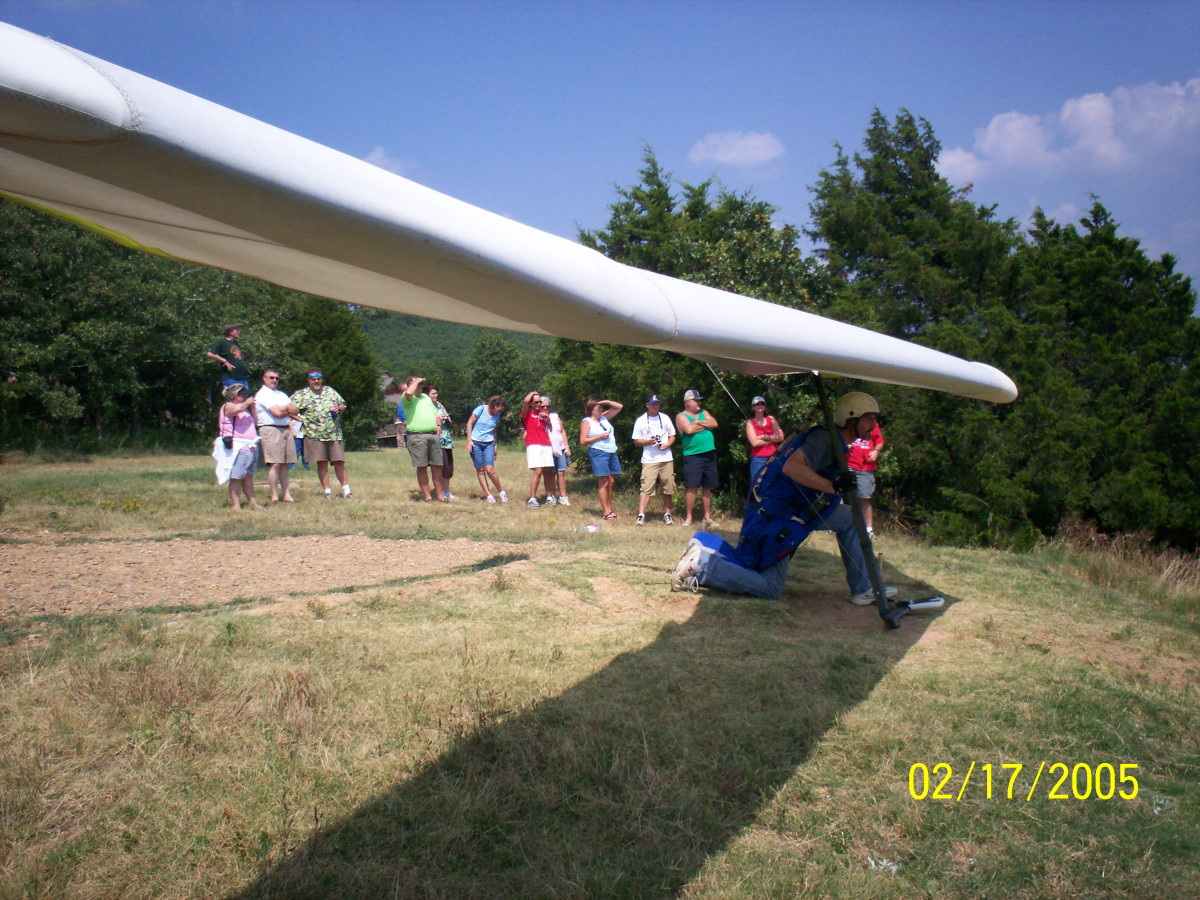
Roy Mahoney launching at Magazine in 2005 - photo by Mel Hair
Albright LZ
35.1336 -93.6442 Waveland, Arkansas
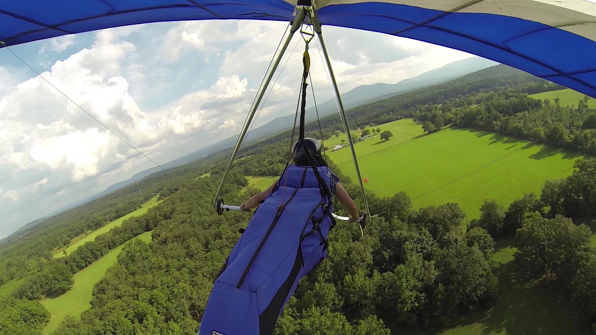
photo by Donna Stokes
The entrance to the Albright farm is located 7 miles west of Havana, Arkansas, on Arkansas highway 10. The entrance can be identified by a red gate and cattle guard.
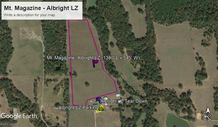
launch = magenta, glider setup = blue, parking = yellow
Notes
Vehicle parking is located on the east side of the Albright home. Please observe the "No Parking Beyond This Point" sign at the end of the lane. No vehicles are allowed in the landing zone.
PG
PG landings can be more easily made in east or west wind final approaches.
HG
There are significant obstacles to be avoided when entering the field from the air. Power lines run north and south along the west boundary of the field and west to east just south of the house. The north and east side of the field is bordered with large trees and the north end of the field (typical base leg into the field) is narrower. For a safe final approach (flying south), stay low to the trees as you enter the field avoiding the large tree in the middle west third of the field.
[we need photos of Albright LZ]
Beatty alternate LZ
35.1311 -93.6696 Waveland, Arkansas
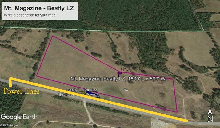
Notes
The Beatty LZ is located 1.5 miles directly west of the Albright Farm on Arkansas Highway 10. When the predominant winds in the valley are easterly or westerly, the Beatty LZ is ideal since the Albright field is best in a north or south final approach.
PG
It is a long glide to the LZ!
HG
The field does have some negligible obstacles on the east side of the field: building, pond, and trees. Power lines border the highway on the south side of the field. The Beatty’s typically have cattle in the field and caution should be used to avoid them. Parking is limited at the Beatty LZ. There is an access road on the south side of the highway and can be used for parking if the road is not blocked.
